Community Maps
What is a map?
map (map), n., v. mapped, mapping, n. 1. a drawing representing selected features of the earthʼs surface or part of it. 2. a map like drawing of anything: a highway way, a weather map. v. 1. to make a map of; show on a map. 2. to collect information for a map by exploring or surveying a region.
Simply stated, a map is a picture of a place. There can be many different maps of the same place and one map cannot show everything about a place. In order for a map to communicate clearly it must show a limited number of things. Thus, all maps are inherently biased in that they only show what the mapmakers choose to show.
Maps are made for different reasons. Some maps are made to show property lines and other maps show us how to get where we want to go. Pirates once used maps to hide and find buried treasure. There are also weather maps that show precipitation (rain, sleet, snow) and cold fronts in a particular region.The most important function of a map is to show location—where certain things are. Maps also show the characteristics of a place that make it unique and different from other places. Another common feature among most maps is that they show distances between things.
*Roland, C. (2002, January). The Community Maps Project. Retrieved from http://www.artjunction.org/archives/CommunityMapsProject.pdf
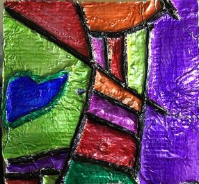
Objective: In this lesson you will create a 3D yarn & foil relief map using line and positive and negative space.
Materials: Cardboard pieces, Tin foil, Yarn, Glue, Colored permanent makers, Sandpaper, shoe polish (optional)
Things to think about:
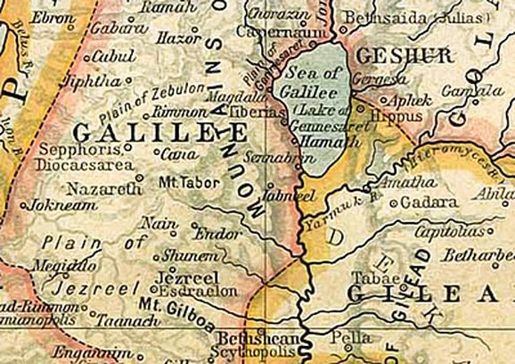
Above is a map of where Jesus lived and walked. In the Bible Peter tells us "Christ...suffered for us, leaving us an example, that we should follow his steps" (1 Peter 2:21). As you create a map of your neighborhood, think about how your steps can reflect Jesus to the people that live around you.
Process:
Tip: Choose and use specific color schemes to give your map a unique look.
Tip: Lightly sanding can be used to distress the color and shine of the foil.
Tip: Dry erase markers can be used as erasers. Simply color over permanent marker mistakes with dry erase marker and wipe off with a wet paper towel.
Standards:
VA:Cr.1.2
VA:Cr.2.1
Above is a map of where Jesus lived and walked. In the Bible Peter tells us "Christ...suffered for us, leaving us an example, that we should follow his steps" (1 Peter 2:21). As you create a map of your neighborhood, think about how your steps can reflect Jesus to the people that live around you.
Process:
- Look at mapping art by Florian Freier, Kim Baranowski, and Linda Glass. Check out this Flickr group of Cartographers.
- Find your neighborhood on Maps, Google Earth, or Google Maps. Print it out for reference. Use a pencil to draw your map on a piece of cardboard.
- Think about the types of lines you will use in your map. What colors will your use?
- Using glue, trace the lines of your map and apply yarn to the glue lines. Building yarn up to 3-4 pieces wide can help create emphasis within your map.
- After the yarn lines are dry, paint glue over the cardboard piece and lay a piece of tin foil on top. The foil should be large enough to overlap the cardboard. Fold over and tape the foil to the back of the cardboard.
- After the glue is dry, add colored permanent marker to the foil surface. Color areas solid as well as blending marker colors by overlapping marker ink areas into gradations or value changes.
- “Age” the edges of the artwork with black or brown shoe polish to create a worn look.
Tip: Choose and use specific color schemes to give your map a unique look.
Tip: Lightly sanding can be used to distress the color and shine of the foil.
Tip: Dry erase markers can be used as erasers. Simply color over permanent marker mistakes with dry erase marker and wipe off with a wet paper towel.
Standards:
VA:Cr.1.2
VA:Cr.2.1


